Rajasthan (India)
Rajasthan, the largest state of India, has Jaipur as its
capital. It has 32 districts.
The Aravali Range runs across the state from Mount Abu, which is 1,722 m in height to Khetri. Most of the region of Rajasthan is covered by the Thar Desert.
The state economy is mainly agricultural and pastoral. Sugarcane, pulses, oilseeds, cotton and tobacco are the major crops of the region.
The Indira Gandhi Canal irrigates the northwest Rajasthan. It is also the largest producer of marble and sandstone. These minerals are excavated at Makrana near Jodhpur.
It has rich salt deposits at Sambhar and copper mines at Khetri and Dariba. The service sector comprises industries like tourism and real estate. Because of its natural beauty and great history, Rajasthan also has a flourishing tourism industry.
Many old and neglected palaces and
forts in Rajasthan have been converted into heritage hotels. The palaces of
Jaipur, lakes of Udaipur, temples of Bikaner and desert forts of Jaisalmer are
the favorite spots for tourists, both Indian and foreign. Mount Abu is the only
hill station of this state. The famous Thar Desert is also located here.
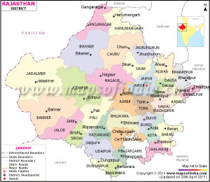
A Rajasthan map shows that there are 33 districts in Rajasthan and they are categorized into seven divisions:
A Rajasthan map shows that there are 33 districts in Rajasthan and they are categorized into seven divisions:
Ajmer Division: Ajmer, Nagaur,
Bhilwara, Tonk.
Bikaner Division: Churu, Bikaner,
Hanumangarh, SriGanganagar
Bharatpur Division: Dholpur,
Bharatpur, Sawai Madhopur and Karauli.
Jodhpur Division: Jaisalmer, Barmer,
Jodhpur, Jalore, Sirohi, and Pali.
Jaipur Division: Alwar, Jaipur,
Sikar, Jhunjhunu, Dausa.
Udaipur Division: Chittorgarh,
Banswara, Dungarpur, Pratapgarh, Rajsamand, Udaipur
Kota Division: Bundi, Baran, Kota,
Jhalawar.
|
District
|
Headquarters
|
Division
|
Population (2011)
|
Area (km2)
|
|
Ajmer
|
Ajmer
|
Ajmer
|
2584913
|
8481
|
|
Alwar
|
Alwar
|
Jaipur
|
3671999
|
8380
|
|
Banswara
|
Banswara
|
Udaipur
|
1798194
|
5037
|
|
Baran
|
Baran
|
Kota
|
1223921
|
6955
|
|
Barmer
|
Barmer
|
Jodhpur
|
2604453
|
28387
|
|
Bharatpur
|
Bharatpur
|
Bharatpur
|
2549121
|
5066
|
|
Bhilwara
|
Bhilwara
|
Ajmer
|
2410459
|
10455
|
|
Bikaner
|
Bikaner
|
Bikaner
|
2367745
|
27244
|
|
Bundi
|
Bundi
|
Kota
|
1113725
|
5550
|
|
Chittorgarh
|
Chittorgarh
|
Udaipur
|
1544392
|
10856
|
|
Churu
|
Churu
|
Bikaner
|
2041172
|
16830
|
|
Dausa
|
Dausa
|
Jaipur
|
1637226
|
2950
|
|
Dholpur
|
Dholpur
|
Bharatpur
|
1207293
|
3084
|
|
Dungarpur
|
Dungarpur
|
Udaipur
|
1388906
|
3770
|
|
Hanumangarh
|
Hanumangarh
|
Bikaner
|
1779650
|
12645
|
|
Jaipur
|
Jaipur
|
Jaipur
|
6663971
|
14068
|
|
Jaisalmer
|
Jaisalmer
|
Jodhpur
|
672008
|
38401
|
|
Jalor
|
Jalore
|
Jodhpur
|
1830151
|
10640
|
|
Jhalawar
|
Jhalawar
|
Kota
|
1411327
|
6219
|
|
Jhunjhunu
|
Jhunjhunu
|
Jaipur
|
2139658
|
5928
|
|
Jodhpur
|
Jodhpur
|
Jodhpur
|
3685681
|
22850
|
|
Karauli
|
Karauli
|
Bharatpur
|
1458459
|
5530
|
|
Kota
|
Kota
|
Kota
|
1950491
|
12436
|
|
Nagaur
|
Nagaur
|
Ajmer
|
3309234
|
17718
|
|
Pali
|
Pali
|
Jodhpur
|
2038533
|
12387
|
|
Pratapgarh[1]
|
Pratapgarh
|
Udaipur
|
868231
|
41173.6
|
|
Rajsamand
|
Rajsamand
|
Udaipur
|
1158283
|
4768
|
|
Sawai Madhopur
|
Sawai Madhopur
|
Bharatpur
|
1338114
|
10527
|
|
Sikar
|
Sikar
|
Jaipur
|
2677737
|
7732
|
|
Sirohi
|
Sirohi
|
Jodhpur
|
1037185
|
5136
|
|
Sri Ganganagar
|
Sri Ganganagar
|
Bikaner
|
1969520
|
7984
|
|
Tonk
|
Tonk
|
Ajmer
|
1421711
|
7194
|
|
Udaipur
|
Udaipur
|
Udaipur
|
3067549
|
17279
|
|
Rajasthan
|
Jaipur
|
|
68621012
|
342239
|
Demographic features of Rajasthan
The population of the state is mostly Rajasthani. The various religions or faiths representing the population are as follows:
Hindus - 88.8%
Muslims - 8.5%
Jains - 1.2%
Sikhs - 1.4%
In addition, there are some Sindhi people who live in the state. They arrived to the territory from the Sindh area (currently a part of Pakistan) at the time of the partition of the two countries in 1947.
The first language of the most of the population in the state is Rajasthani. Hindi and Rajasthani are the two most significantly spoken languages in the state. In a number of schools, the Rajasthani language is utilized as a medium of teaching together with English and Hindi. Sindhi, Gujarati, and Punjabi are the other languages in the state.
Comments
Post a Comment